
Saint Nicholas Parish
San Nicolò dei Mendicoli
Nicolo Saltano was born in 1355 in the parish of San Nicolò dei Mendicoli, St. Nicholas of the Beggars. It is located at the western extremity of the Venetian archipelago (yellow dot below), on the shore of the large channel known as the Giudecca Canal. The island of Giudecca hugs the south flank of Venice, separated by the 500 foot wide, two mile long navigable channel that meets the Grand Canal at St. Mark’s Basin in front of the Doge’s Palace. St. Nicholas is two miles by foot to St. Mark’s Square (blue dot). The map is Jacopo di Barbari’s 1500 (MD) bird’s-eye view of Venice. In 1368 St. Nicholas parish was hardly more than a fishing village distant from the civic center at St. Mark’s and the commercial center of Rialto.

Di Barbari’s map clearly shows the campanile (belltower) of St. Nicholas at the center top (blue dot), a square 11th century structure. The south flank of Venice, from St. Nicholas to the Customs House, was home to boatyards and wharves. Sections of this shoreline were crowded with wooden rafts and the area is still known as the Zattere (zattera meaning raft. Several can be seen in the lower right corner).

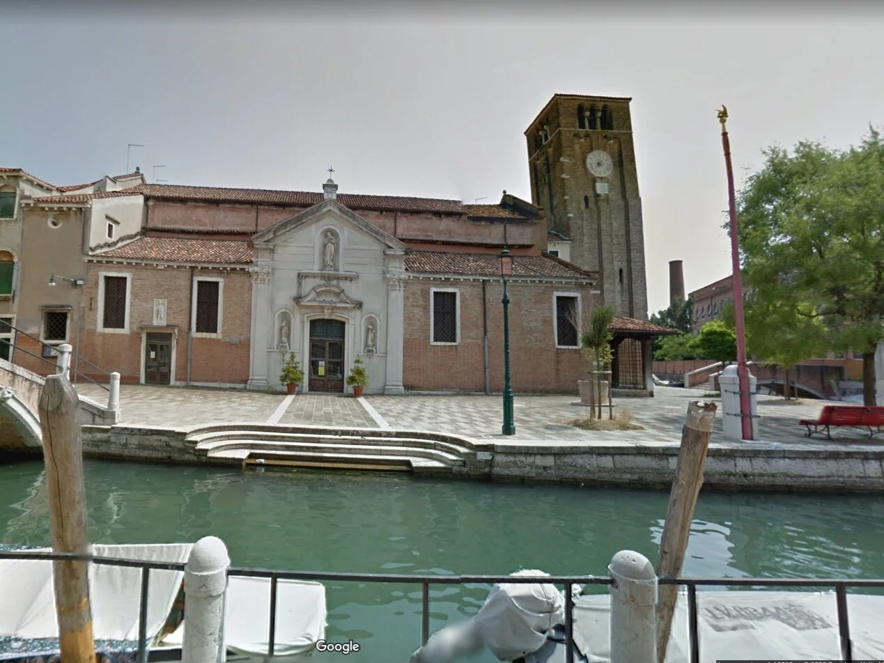

The original church may have been built as early as the 8th century by refugees from Padua, making it one of the oldest churches in Venice, and a rare example of Veneto-Byzantine architecture. The first church was destroyed by fire in 1105, rebuilt later that century, restored in 1361, 1553, and again in 1750 and 1970. The original entrance was where the porch is now (above left). The central portal of Istrian stone (above center) on the side of the building was part of later restorations, when the entrance was moved from the front to the side. (Above right) the belltower seen from behind the church.

With a tree obscuring the side entrance, it is easier to see the original plan of the church. “Poor but virtuous” women were allowed to shelter in the front porch. Note the well (pozzo) between the tree and the lamppost. The wells are a feature of every square and many courtyards in Venice. Venice had no fresh water except for rainfall. The wells captured the rain through grates in the ground around it and filtered the rainwater through sand before collecting it in the cistern. The wells supplied the city’s water, which could also be bought from boats ferrying water from the mainland. The water of the lagoon and canals is half-salt, half-fresh, good for fishing and swimming but undrinkable.
BELOW:
Left, St. Nicholas Parish and Center, St. Mark’s, from a 1636 map after Di Barbari. Right, a narrow passage between buildings.


The slide show below represents the opening chase in “The Ballot Boy,” from St. Nicholas parish to St. Mark’s Square. The map is from 1636. Almost 200 years earlier, when Nico chased the thief, the city was less densely developed, the individual islands more clearly separated, and the shoreline more irregular and exposed at low tide.


